Maps
Cyprus Map
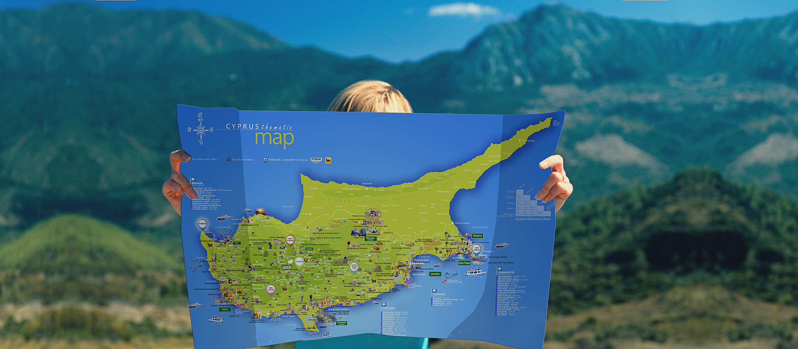
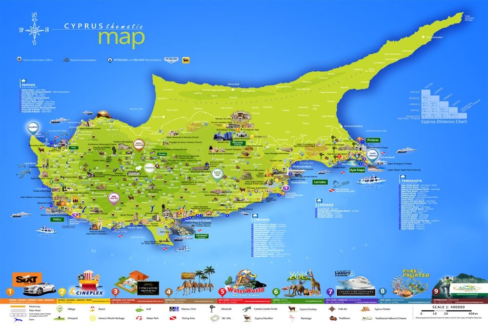
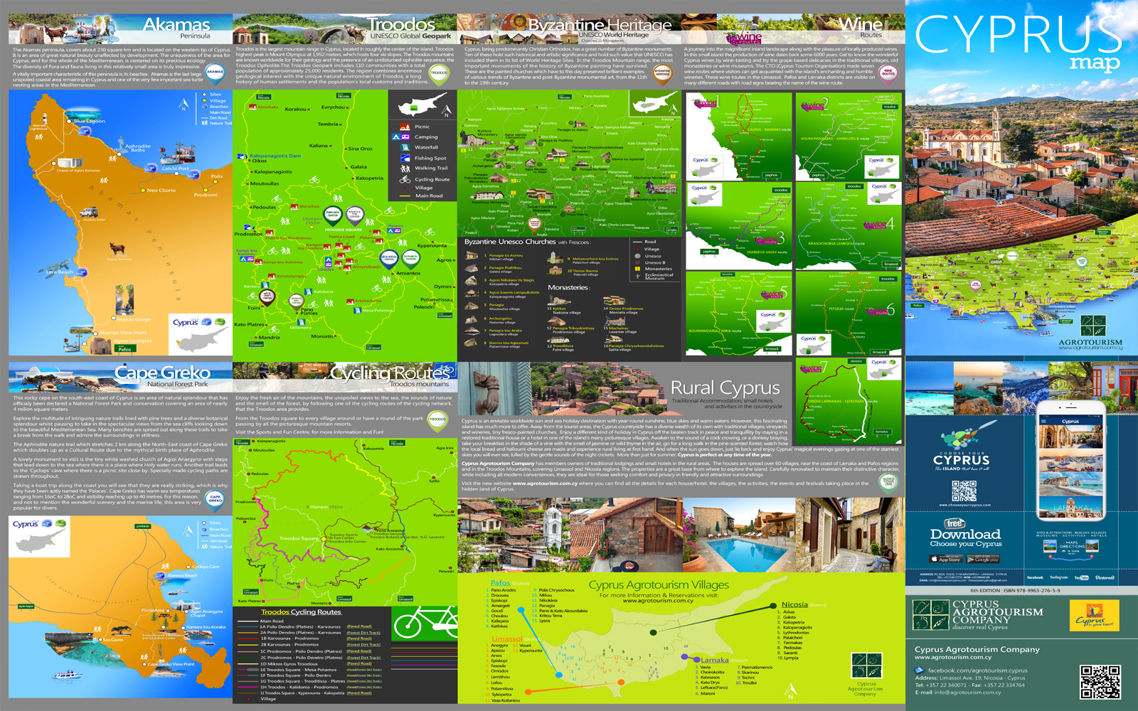
Cyprus is the third largest island in the Mediterranean and has a land area of 9,251 km². The map shows the island of Cyprus in the Eastern Mediterranean Sea. Cyprus is located about 80 km (50 mi) south of the coast of Turkey, east of the island of Crete (Greece.), west of Syria and Lebanon, northwest of Israel, and north of the Sinai Peninsula (Egypt). You can find real pictures of Cyprus regions, roads, cities, streets, buildings,attractions, monuments, beaches and much more.
Troodos Map
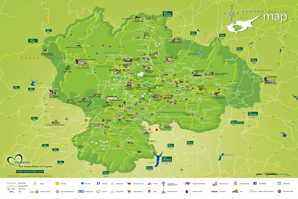
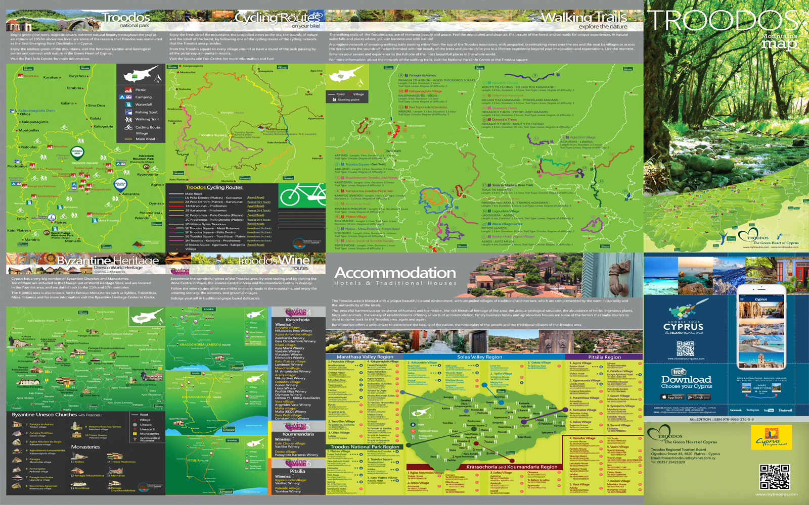
The Troodos area is blessed with a unique beautiful natural environment, with unspoiled villages of traditional architecture, which are complemented by th warm hospitality and the authenticity of the locals. The Troodos Mountains are the biggest mountain range in Cyprus, culminating in the historic Mt. Olympus at 1952 meters. . See the island from a different perspective; go to the mountains of Cyprus. At 6,500 feet above sea level, the tip of Troodos gives amazing 360o views of the whole island.Troodos maps and visitor information.
Nicosia Maps
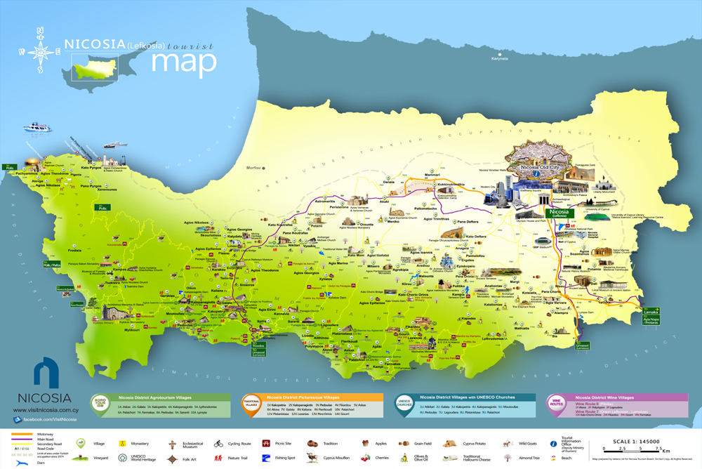
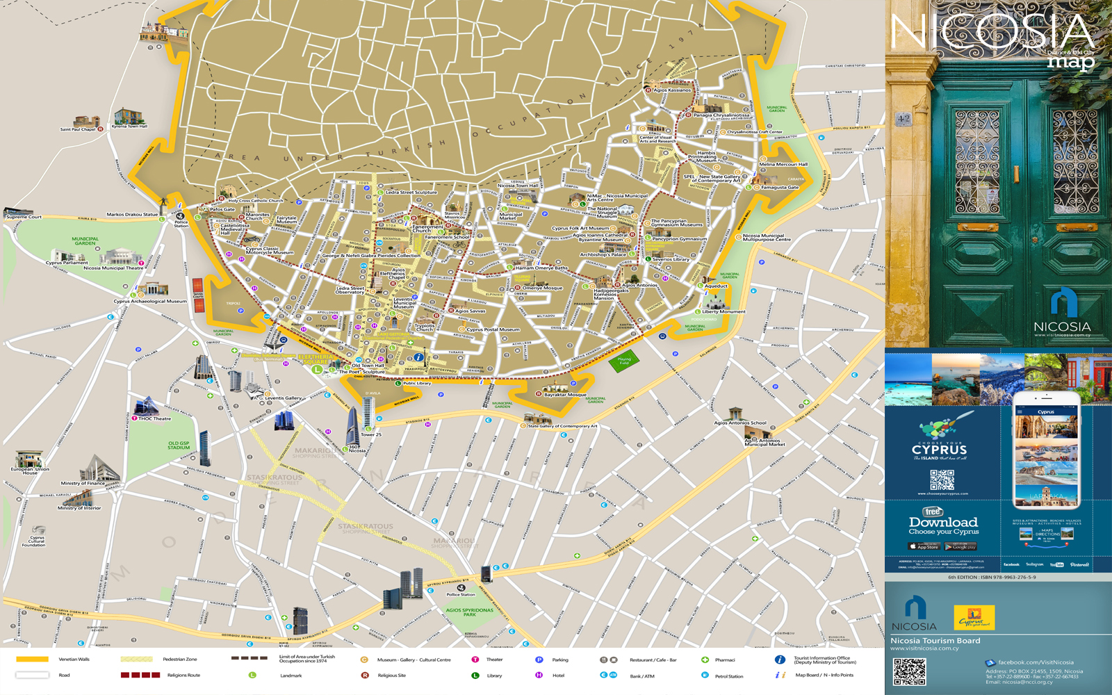
Where is Nicosia located? Discover all the best places to visit in Nicosia. Explore now the maps of Nicosia and be ready to live the adventure.
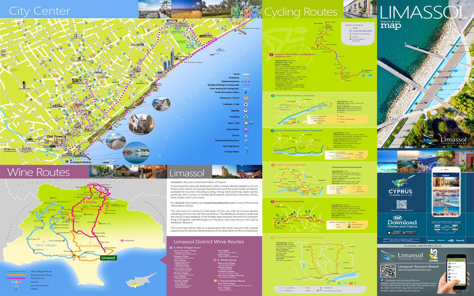
Limassol Maps
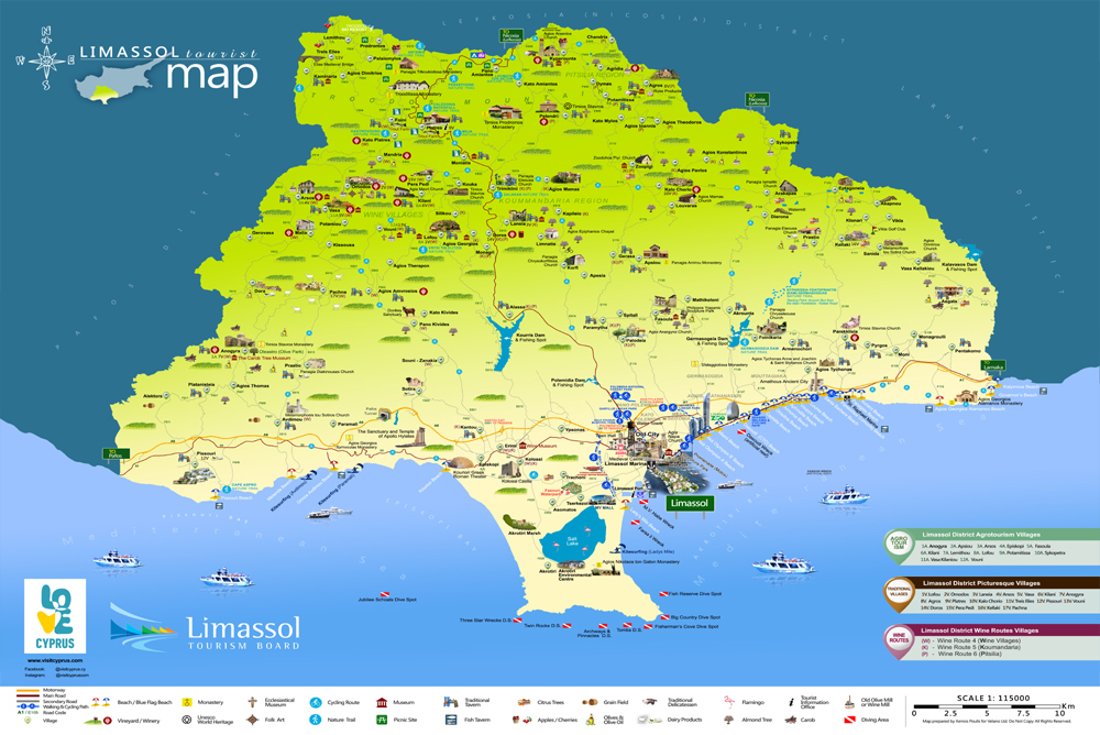
Where is Limassol located? Discover all the best places to visit in Limassol. Explore now the maps of Limassol and be ready to live the adventure.
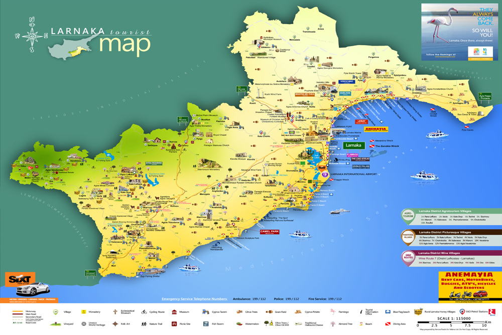
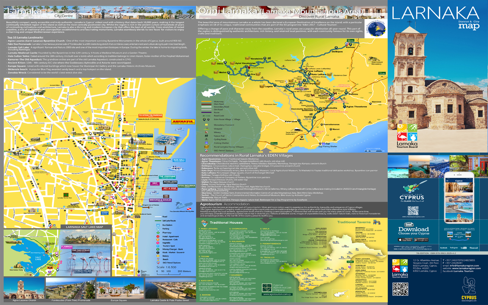
Larnaca Map
Where is Larnaca located? Discover all the best places to visit in Larnaca. Explore now the maps of Larnaca and be ready to live the adventure.
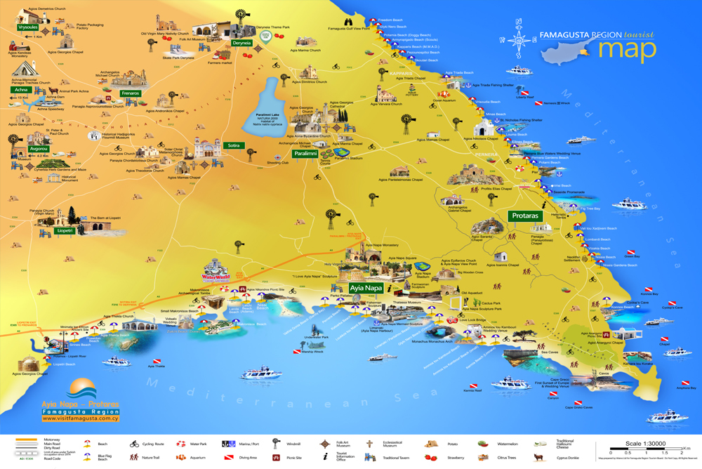
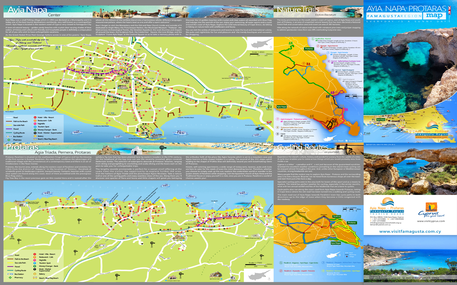
Famagusta Map
Large district map and street map of Ayia Napa and Protaras town centers, plus tourist information about the two towns and area.
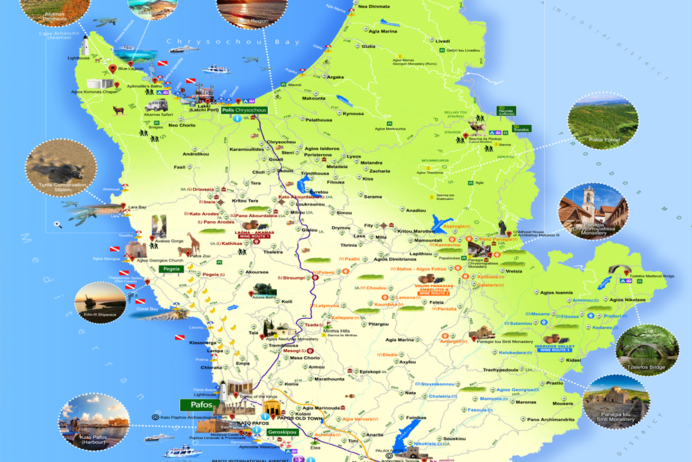
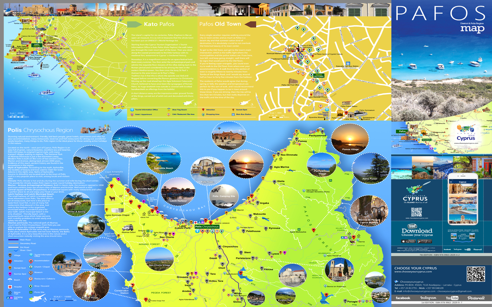
Paphos Map
Where is Paphos located? Discover all the best places to visit in Paphos. Explore now the maps of Paphos and Polis region and be ready to live the adventure at Aphrodite’s birthplace.
 Cities/District
 Monasteries
 Unesco Churches
 Food & Drink
  Limassol to Nicosia
 Famagusta to Machairas
 Kourion to West Akamas
 Hotels
 Villas
 Agrotourism Accommodations
 Flights
 Rent a Car